Measuring Differences between Rank Variable Wildfire Risk and Burned-Unburned Area Mask: A Case Study from Idaho
Measuring Differences between Rank Variable Wildfire Risk and Burned-Unburned Area Mask: A Case Study from Idaho
Using the Google Earth Engine (GEE) JavaScript API to Examine Wildfire Severity
Team Member:
Brenner Burkholder, Max Lutz, Rahebe Abedi, Ravi Thapaliya, Mina Wei and Vishal Muda
Affiliation:
Clark University
Course:
GEOG 279/ 379
Team Members:
Brenner Burkholder, Max Lutz, Rahebe Abedi, Ravi Thapaliya, Mina Wei and Vishal Muda
Affiliation:
Clark University
Course:
GEOG 279/ 379
Introduction:
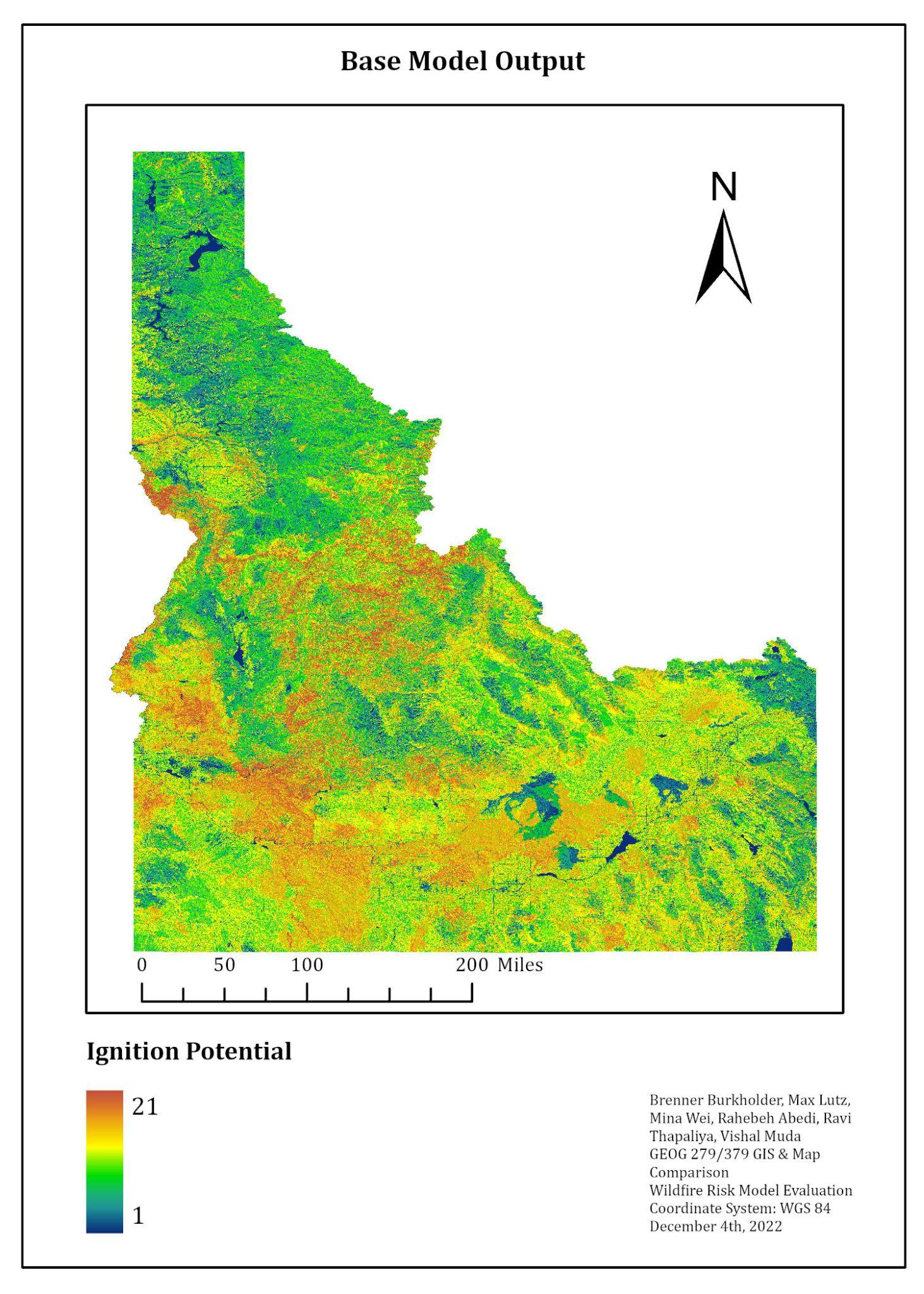
Objectives of this study We created three fire susceptibility maps: Base, NDVI difference, and Evaporative Stress Index (ESI). The Base model uses five static variables. The NDVI difference model combines an NDVI seasonal difference with the same five static variables as the Base model. The ESI model combines one ESI variable with the same five static variables as the Base model. 2. We used the Total Operating Characteristic to compare each ignition suseptability map to a map of fires during the year 2021.
Project Deliverables:
Contact
please contact me at my email address
Email: m.wei2@columbia.edu